Trail App and Signage Project Advisory Committee Updates At their March 27, 2024 Meeting, Council approved the appointment of 7 community members to the Trail App and Signage Project Public notice of our intention to establish a project committee resulted in some feedback from the community on this project. It was suggested that we use an existing app (such as AllTrails or TrailForks) rather than developing a new one. It was also suggested that additional public engagement be carried out, since the last engagement took place in 2018. The project budget has been set at $25,000. The budget includes honoraria for participation in Committee meetings, sign design and printing, public engagement, updating GIS mapping and graphic design work. In September 2024, the Trail Committee presented recommendations to Council on signage and maintenance as well as next steps on the project. In April 2025 the Committee shared their work at the Community market for public input. A follow up presentation was held with the new Council on August 13, 2025. At the August 13, 2025 meeting Council passed the following motion: Motion #259-25 THAT the Trail Committee will work with staff to implement Option 3, as recommended by the Committee on August 13, 2025, and to include the Dezadeash Trail within the trail network map and a trail network sign be installed at the Dezadeash trailhead. The Trail Committee continues to seek review and input on the map. In fall 2025, the Committee's work was reviewed by CAFN Heritage Lands and Resources Trails Working Group. The Committee will also be presenting its latest draft at the Haines Junction/Dakwäkäda Mountain Festival on November 15, 2025, for additional review and input. |
Haines Junction is home to a sizeable network of trails utilized by a broad range of organized and independent/informal recreationists. The Haines Junction Community Recreation Plan (CRP), adopted in 2015, established an intention to “create a multiuse, designated, interconnected and signed trail network”, in effect formalizing an unofficial (and unmaintained) recreation asset. It further set out to “create and promote active connections between recreation and community destinations”.
The Village of Haines Junction (VHJ) recognizes the significant value and importance of trails to Haines Junction residents and there have been a growing number of community conversations in recent months about the role trails could play in attracting more visitation, new residents, and broader economic development to the area.
A comprehensive community engagement process was initiated in 2017 that resulted in the development of a conceptual trail network and implementation plan for a community trail network within the municipal boundaries.
VHJ recognizes the unique relationship it shares with Champagne and Aishihik First Nations (CAFN) and strives to develop and maintain a mutually beneficial and collaborative relationship through this and other initiatives.
View the full report here: 2018 What We Heard Report from the Haines Junction Trail Planning Process
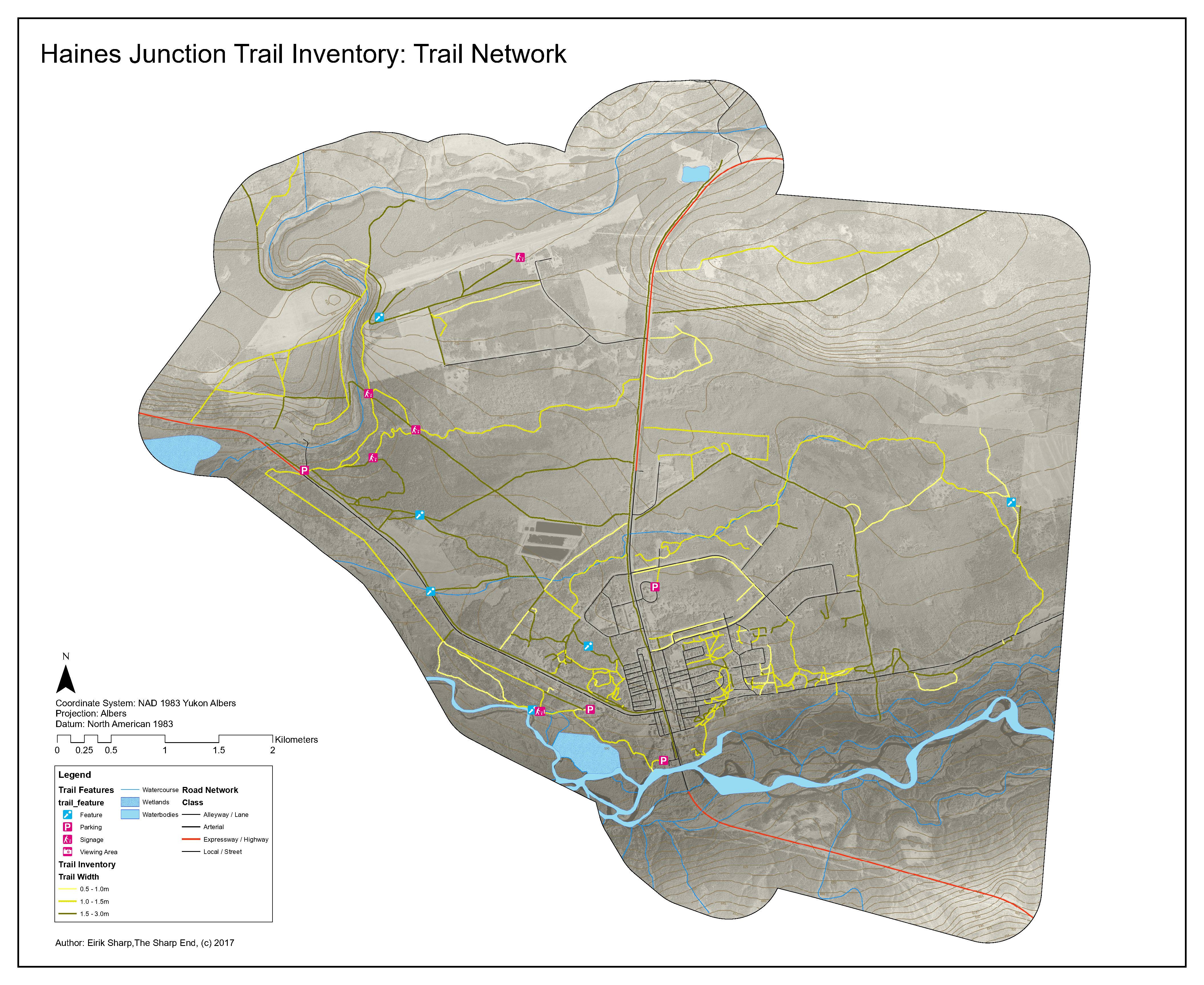 Conceptual Haines Junction Trail Network.
Download map here.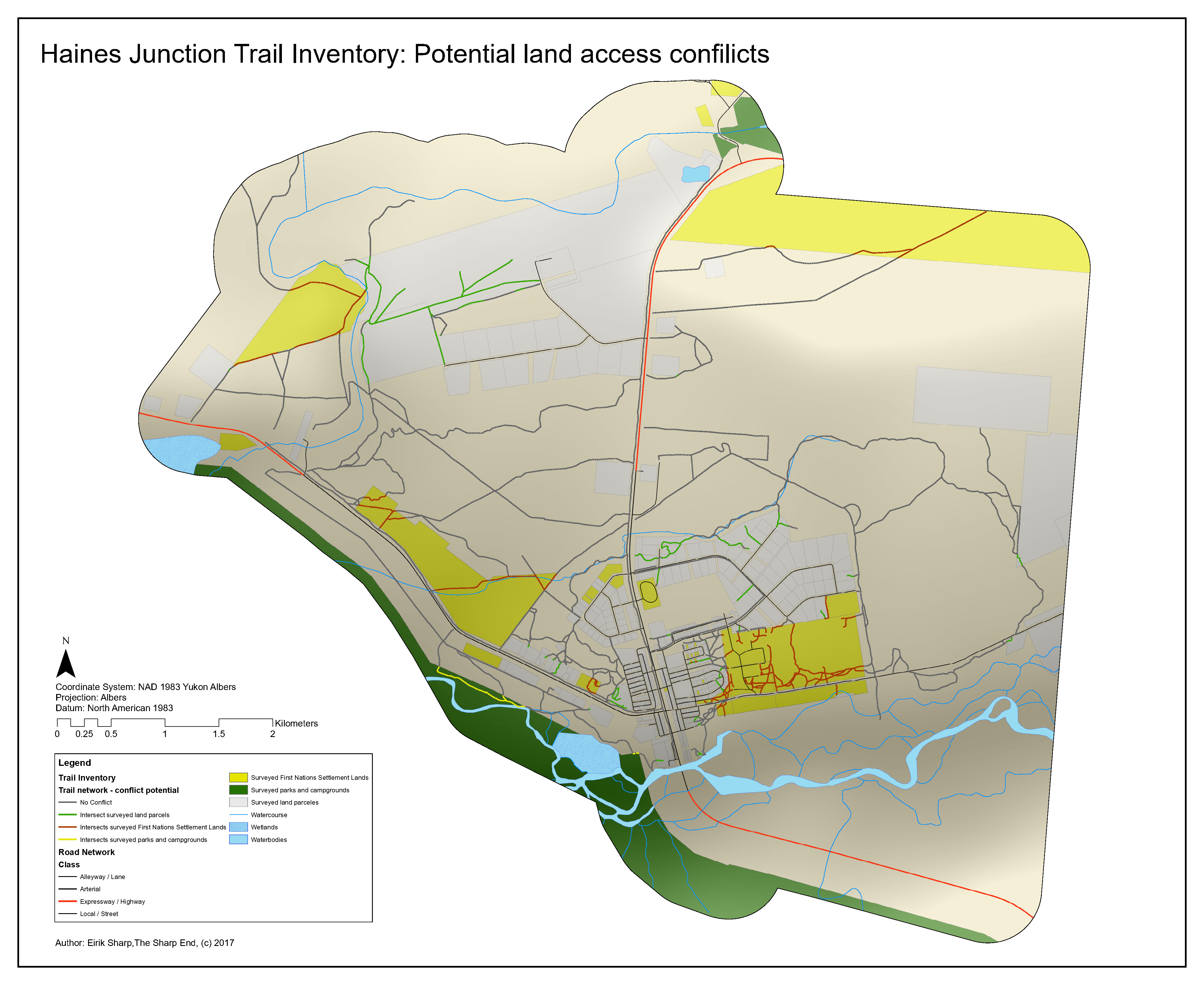 Conceptual Haines Junction Trail Network - Potential Land access conflicts. Download map here.
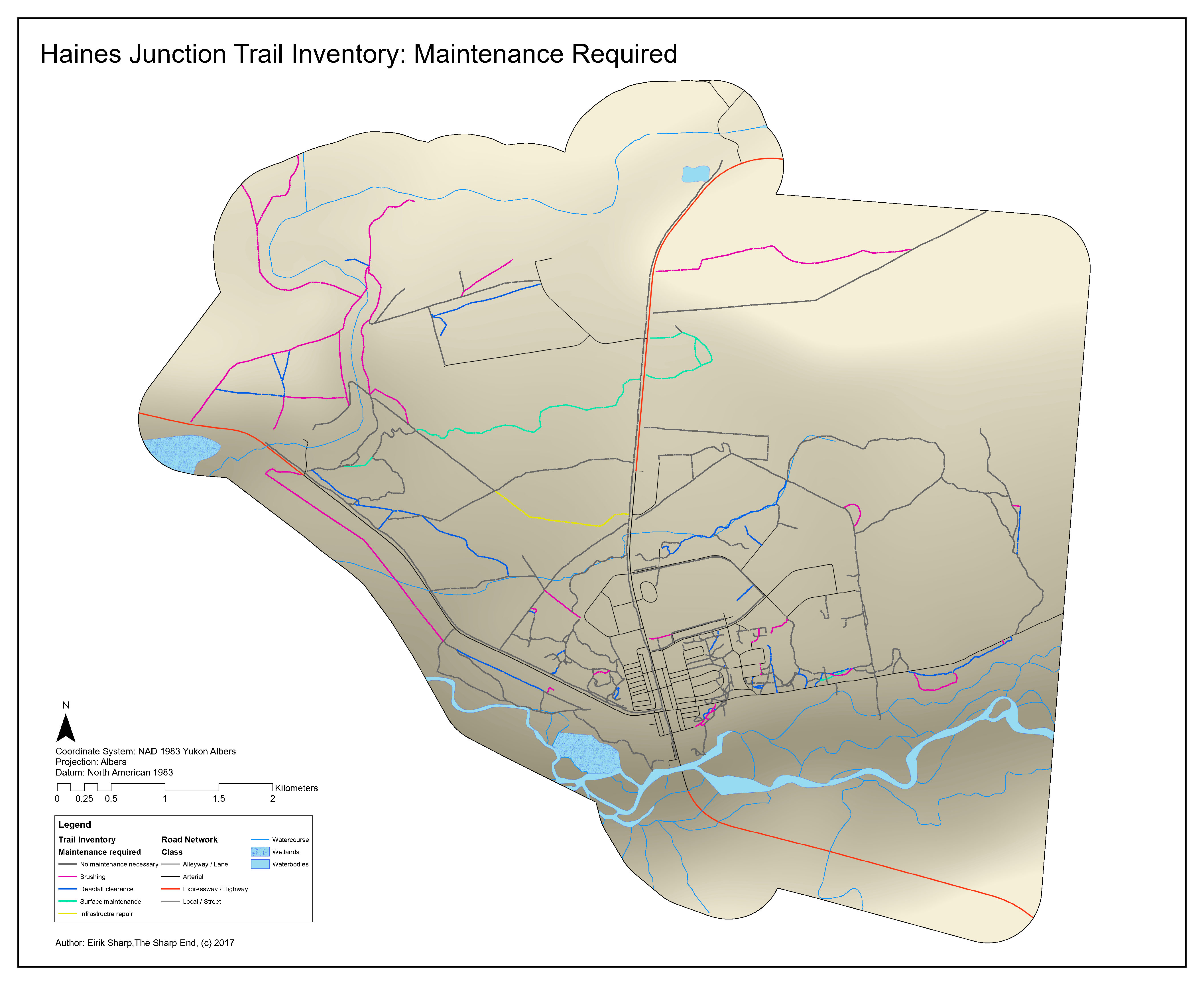 Conceptual Haines Junction Trail Network Maintenance Required.
Download map here.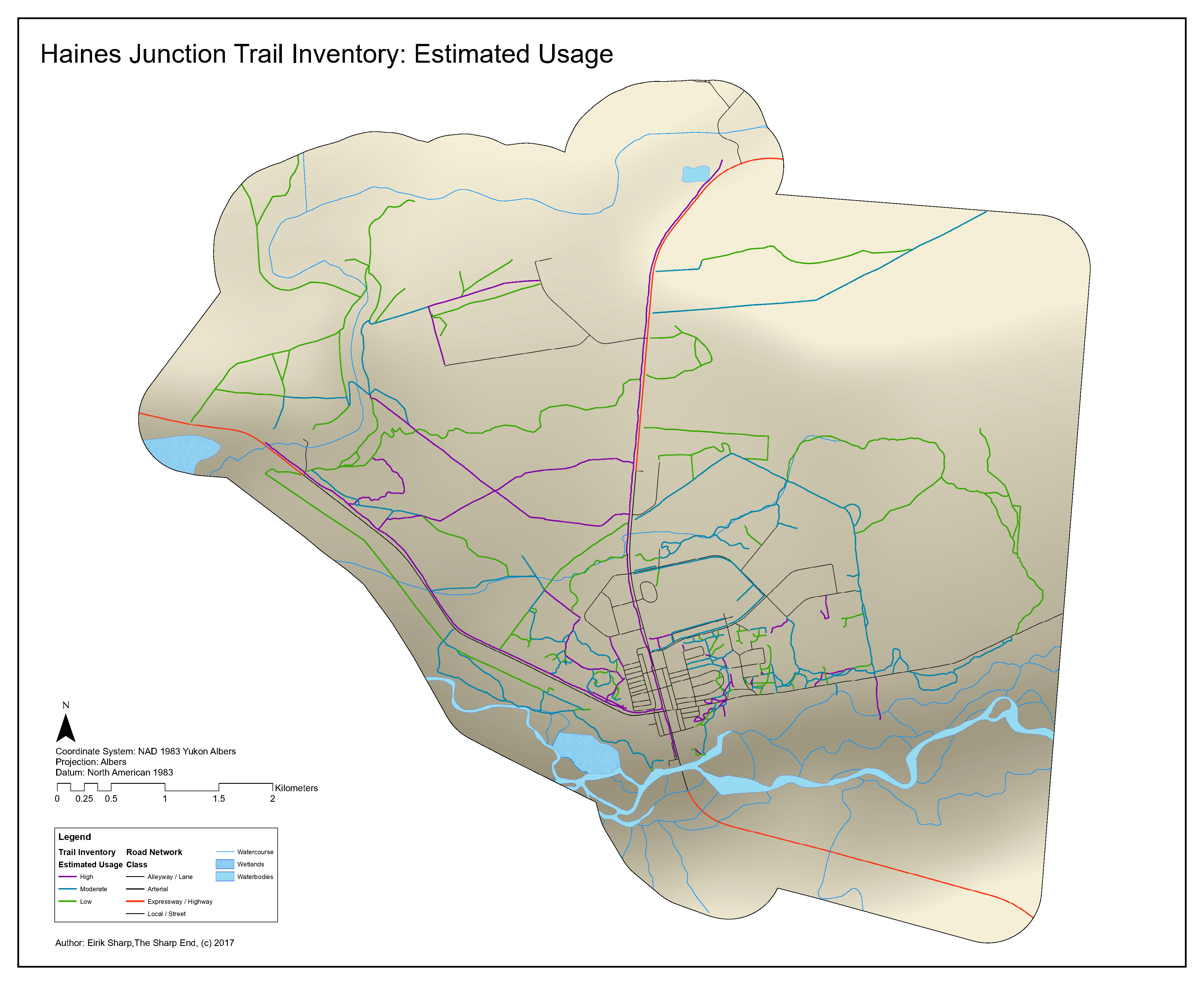 Conceptual Haines Junction Trail Network Estimated Usage.
Download map here.
Historic recreation planning documents:
- 2015-2024 Haines Junction Community Recreation Implementation Plan
- 2015-2024 Haines Junction Community Recreation Implementation Plan
- 2013 Recreation Survey Report